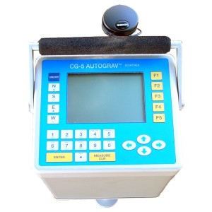
The Department of Geodesy and Gravimetry carries out economic activities through relative gravimeter, high-precision GPS and digital tachometer devices, and geodesic/geo-informative program packets. Offered decisions can be of high precision.
Applications: high-precision calculation of coordinates and deformation; cadastral and topographic surveys;
Instruments: Trimble NetR9; Topcon GB-1000,HiperSR; Leica GX1220,RS500;
Minimum absolute deviation: hirizontal ±3mm, vertical ±10მმ
Minimum distance: is not limited
Application: indoor and outdoor geodetic survey
Instruments: Topcon OS-101;
Minimum relative deviation: ±2mm
Maximum distance: 4000m


